Disaster Coordination Center
Architectural Space of Sharing and Communication
Instructor: Luis Pancorbo
Individual Project
Year: 2019 Spring
Location: Los Angeles, CA
Individual Project
Year: 2019 Spring
Location: Los Angeles, CA
Los Angeles is rated as one of the most dangerous cities to live in the US because of the high frequency of various natural disasters - earthquake, wildfire, extreme heat, landslides, etc. Considering the changing future climate, the occurrence of these disasters will increase and happen more irregularly. However, we are not well prepared for that future.
In the US, There are many different agencies and organizations which can respond to natural disasters, but these agencies are being controlled by different levels of people, and the lack of communication between these agencies is alarming. For example, during Hurricane Katrina, there are some damage which could be prevented if FEMA responds in a more timely fashion. The people who monitor and collect environmental data and the people who give orders during emergency are not the same group, and they only occasionally share their information. This kind of discrepancy will not be able to deal with future climate change, and we need a larger scale of operation and decision making process.
![]()
![]()
![]()
![]()
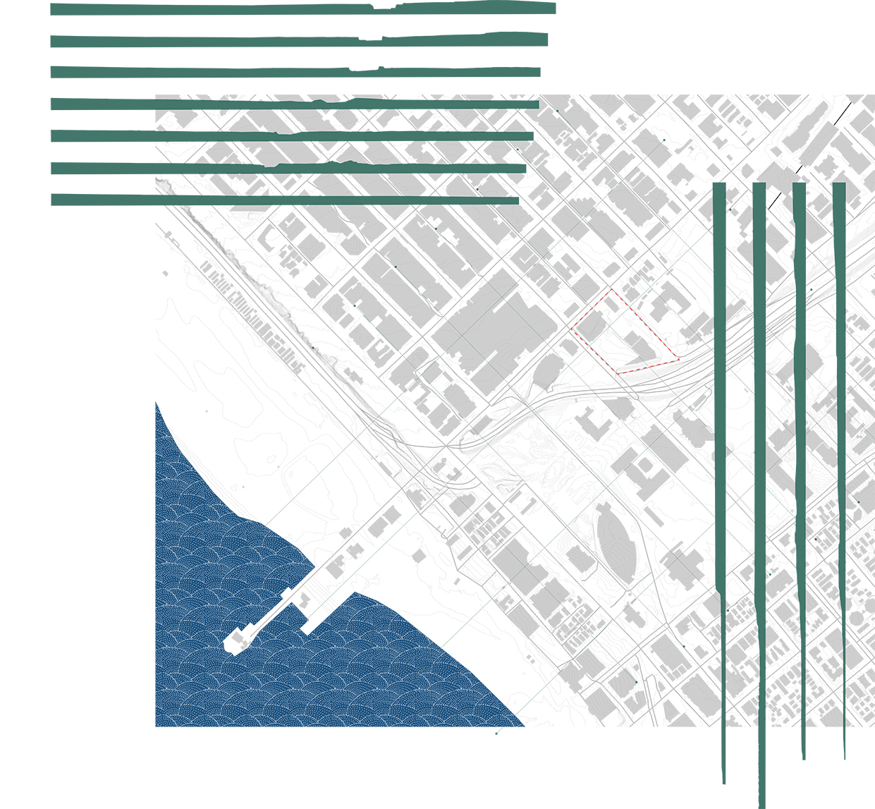
These maps show the frequency and occurrences of natural disasters in the state of California and Los Angeles, as well as the distribution of emergency response center in the state.
![]()
![]()
![]()
This project is a space for different organizations to talk to each other, to share information, and to make decisions together concerning matters with climate change or any related emergencies. By forcing people to be in the same physical space, agencies can have enough empathy with others. Not only sharing information within agencies and organizations, but also sharing information with the general public, and educating the public about the possible future scenarios.
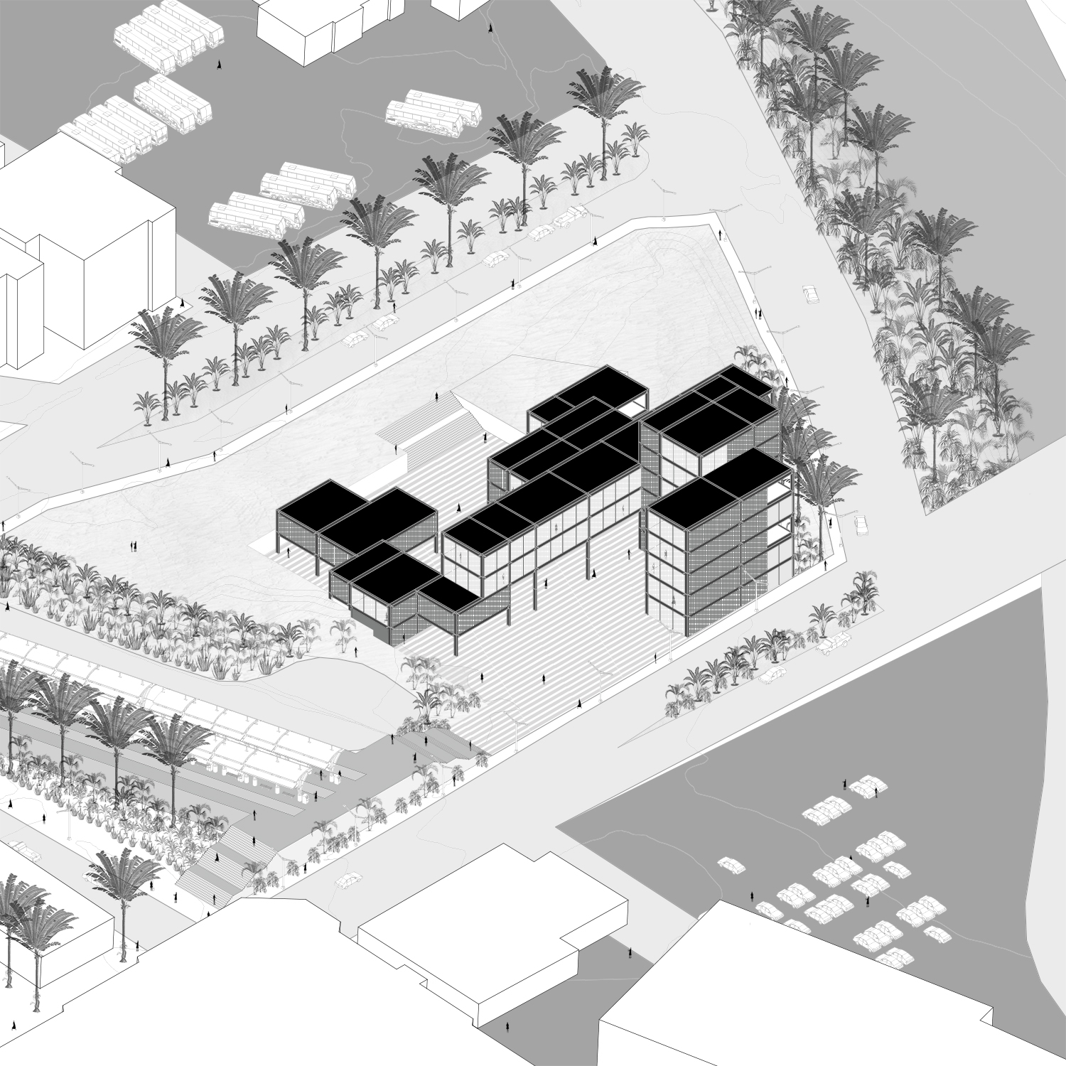
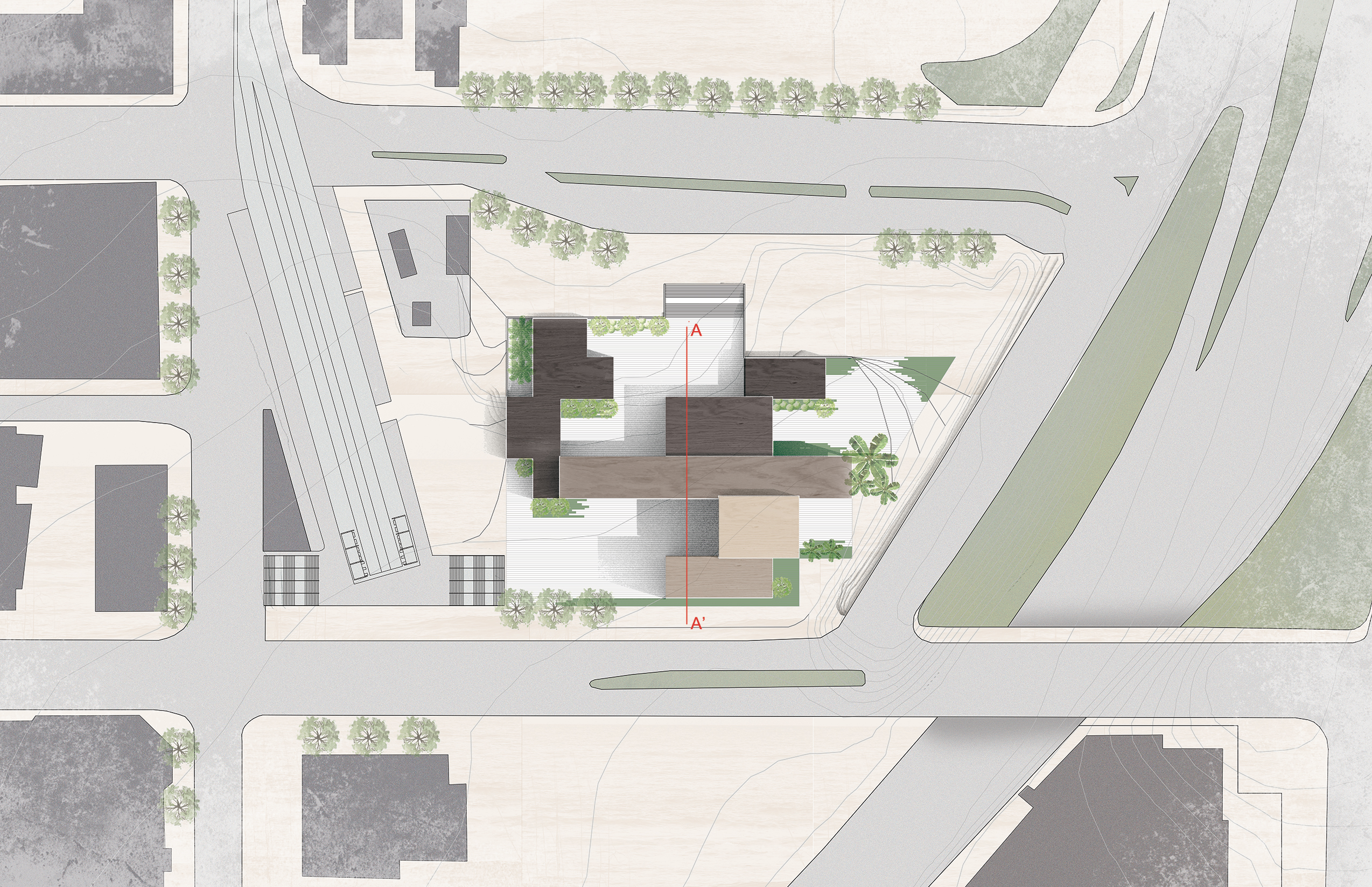
The building is roughly divided for these functions. This south end consists of offices and meeting rooms, the spaces are smaller and more condensed. This east part is open to the public and serves the function of an education center and exhibition spaces. In the middle is a volume of conference space which organizations make decisions. And the north end is utility spaces which also open to the public and can be used during emergencies. People might be able to occupy the space underneath the conference room and use the utilities.
![]()
In the US, There are many different agencies and organizations which can respond to natural disasters, but these agencies are being controlled by different levels of people, and the lack of communication between these agencies is alarming. For example, during Hurricane Katrina, there are some damage which could be prevented if FEMA responds in a more timely fashion. The people who monitor and collect environmental data and the people who give orders during emergency are not the same group, and they only occasionally share their information. This kind of discrepancy will not be able to deal with future climate change, and we need a larger scale of operation and decision making process.
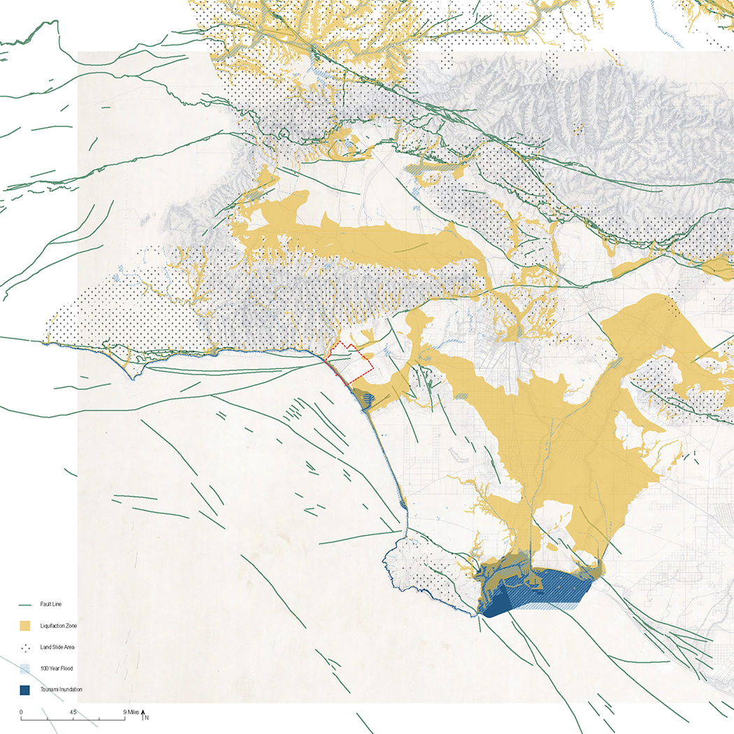


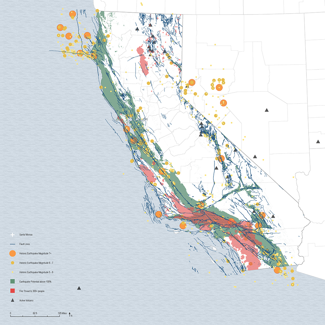
These maps show the frequency and occurrences of natural disasters in the state of California and Los Angeles, as well as the distribution of emergency response center in the state.

This project is a space for different organizations to talk to each other, to share information, and to make decisions together concerning matters with climate change or any related emergencies. By forcing people to be in the same physical space, agencies can have enough empathy with others. Not only sharing information within agencies and organizations, but also sharing information with the general public, and educating the public about the possible future scenarios.
The building is roughly divided for these functions. This south end consists of offices and meeting rooms, the spaces are smaller and more condensed. This east part is open to the public and serves the function of an education center and exhibition spaces. In the middle is a volume of conference space which organizations make decisions. And the north end is utility spaces which also open to the public and can be used during emergencies. People might be able to occupy the space underneath the conference room and use the utilities.
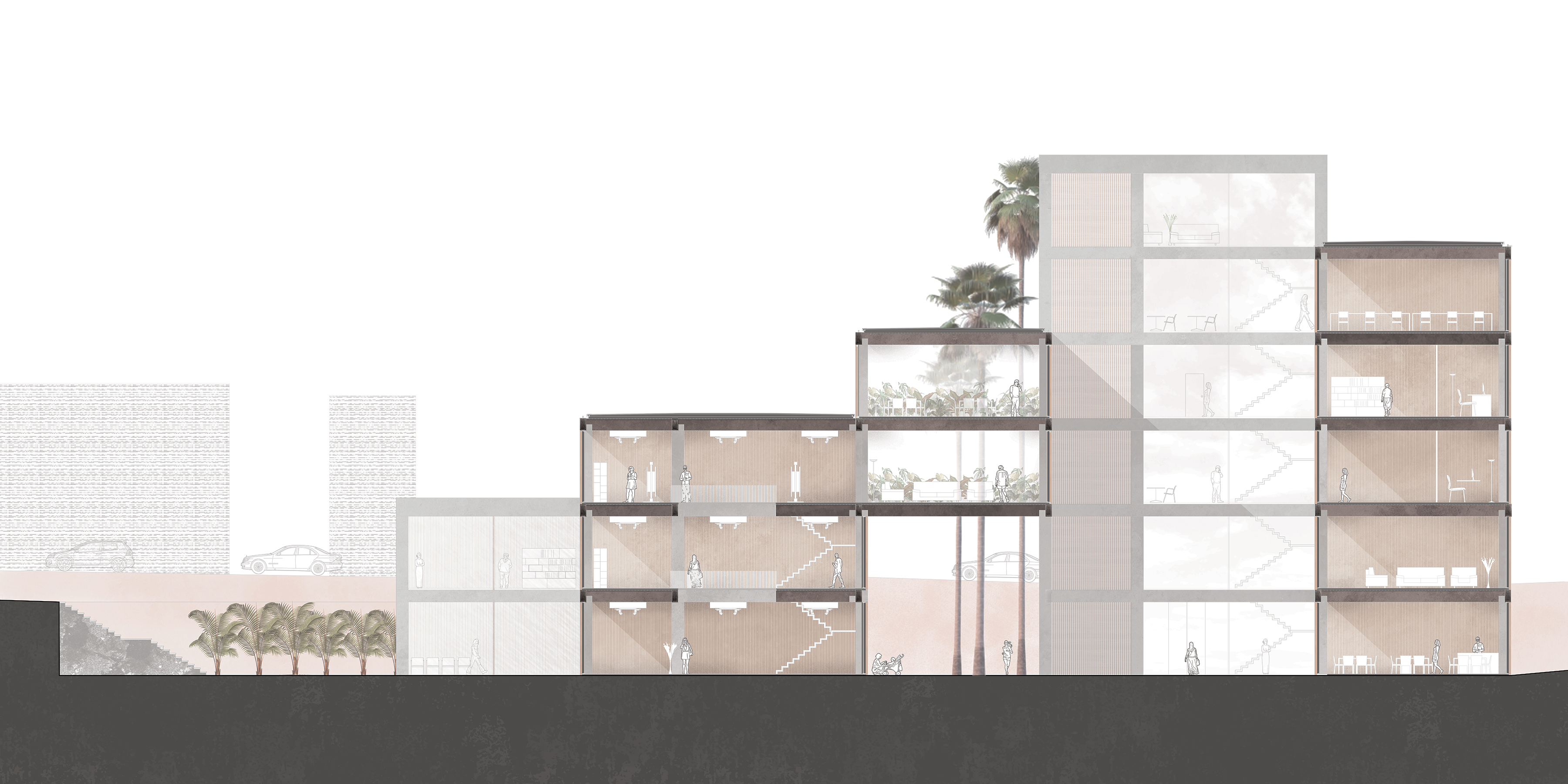


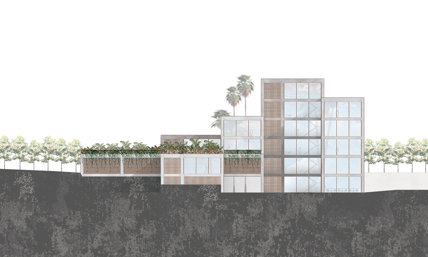
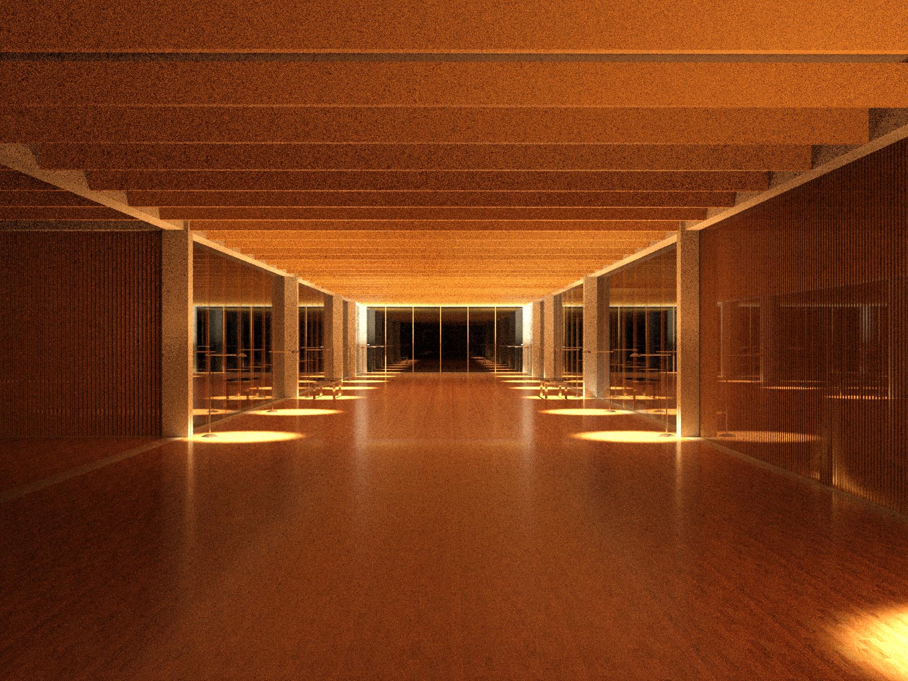
The building is a simple concrete structure with wood panels as facades. The density of the wood panels corresponds with the openness of the programs to the public as well as the Los Angeles sunlight. The material creates a sense of consistency within a building with diverse programs.


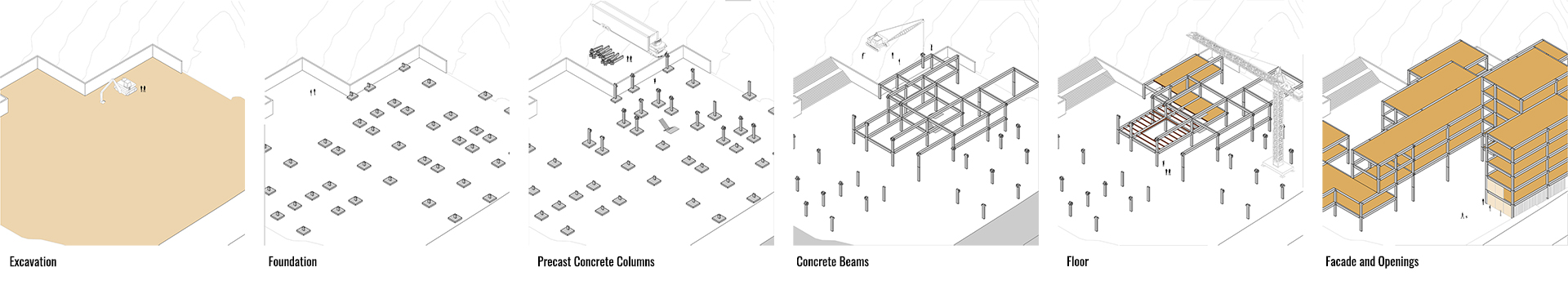
Building Sequences

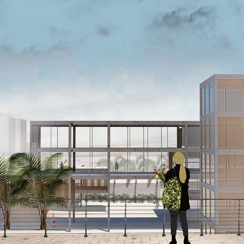
The street view which allows the public to see through the conference rooms and increase government transparency.
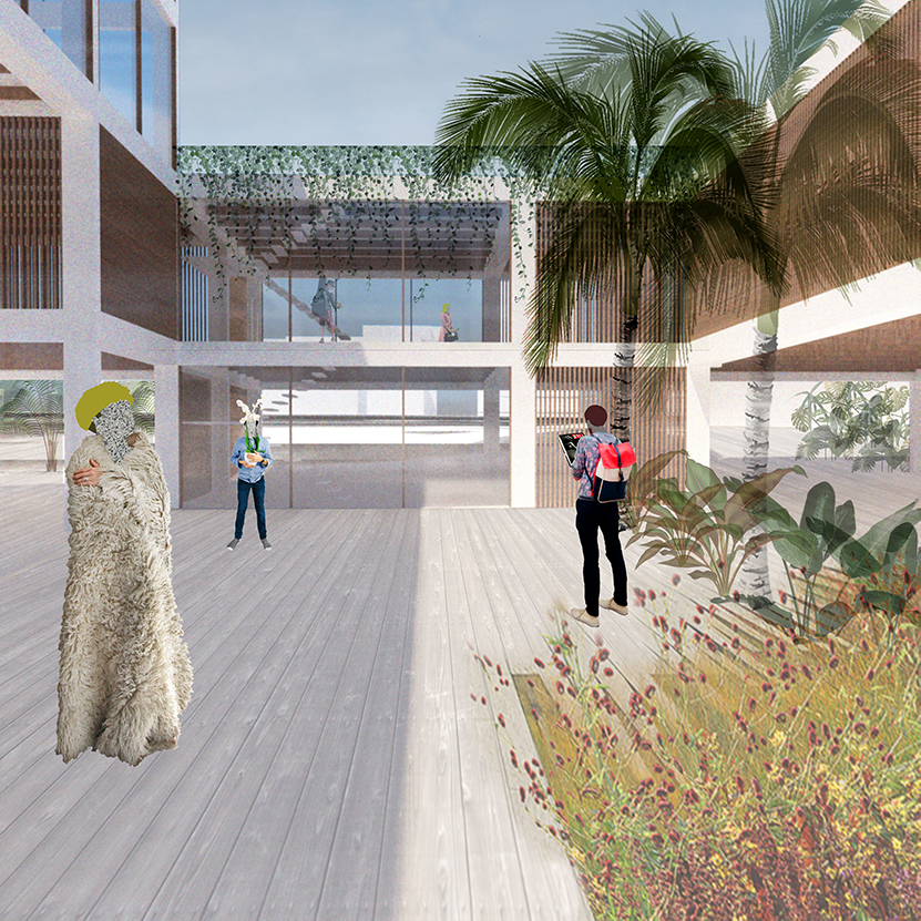
Entrance of public service quarter of the building. The ground floor is open and has the potential of providing shelter for the homeless population in LA.

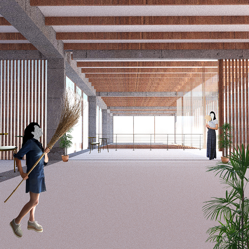
The consistency of building materials units various agencies and programs.
The open space of the conference room connects the private offices and public exhibition.