Assessing Vulnerability
in Norfolk, Virginia
ArcGIS Analysis and Representation
Instructor: Guoping Huang
Individual GIS Project*
Year: 2018 Fall
Location: Norfolk, VA
* All maps generated by ArcGIS
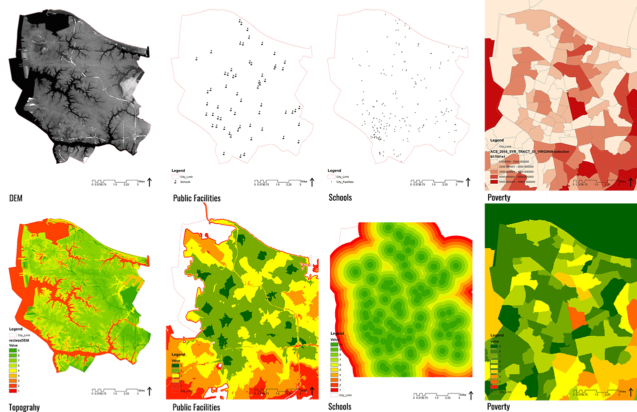
This project takes a scientific approach toward the issue of sea level rise and climate change. Using ArcGIS as a tool, this project shows a complete analysis of the consequence of sea level rise. There are three steps.
The first is to find data. There are many different factors which could have an impact on the vulnerability of places, such as the elevation, distance to storm shelters, road conditions, etc. The second step is to overlay all relevant information with the elevation of the city and determining the most vulnerable places for each aspects; the final step is to combine all results together and make a cumulative decision.
Individual GIS Project*
Year: 2018 Fall
Location: Norfolk, VA
* All maps generated by ArcGIS
This project takes a scientific approach toward the issue of sea level rise and climate change. Using ArcGIS as a tool, this project shows a complete analysis of the consequence of sea level rise. There are three steps.
The first is to find data. There are many different factors which could have an impact on the vulnerability of places, such as the elevation, distance to storm shelters, road conditions, etc. The second step is to overlay all relevant information with the elevation of the city and determining the most vulnerable places for each aspects; the final step is to combine all results together and make a cumulative decision.